SPACE-O
Challenge
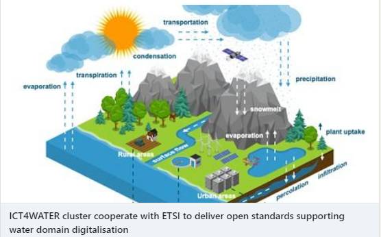
Water is cutting across multiple societal sectors and technology innovation is recognized as the key means to address our increasingly complex and multidisciplinary water challenges and put us on a more sustainable path while supporting economic growth. Space technology can be a catalyst to promote and support technology innovation to protect and ensure the sustainability of water resources by sustaining an environmental information and services value chain.
Sustainable and efficient use of electricity and chemicals in water treatment operations has been identified as one of the biggest challenges for the water sector, together with intensifying water resources protection and management into sectorial policies. SPACE-O addresses the challenges facing the water industry for achieving more sustainable and cost effective operations that create the basis for adding value water management services.
Approach
SPACE-O is integrating state of the art satellite technology for water quality monitoring and advanced hydrologic and water quality modelling using advanced ICT tools for generating real time, short to medium range water quantity and quality forecasts for reservoirs storing water intended for potable use. A state of the art operational coupling of hydrological, hydrodynamic and water quality models will be established to provide near real time, downscaled water quality forecasts in water reservoirs. Advanced Data Assimilation from EO and in situ sensors will be used to improve short- and long-term forecasts by correcting the model state initialization. Furthermore, a complete operational value chain from EO to water business sector will be established by developing a Decision Support System in order to enable cost-effective and environmental sustainable WTPs operation.
EMVIS is the coordinator of this 2-years innovation project and bears the responsibility for the efficient planning, organization and management of the core tasks of the project, in order to ensure that the vision and the objectives of SPACE-O will be met on-time with the highest quality standards. EMVIS has also a substantial scientific contribution in SPACE-O being responsible for the implementation and operationalization of the hydrodynamic and water quality forecasting service line and the development of the Decision Support System.
Impact
SPACE-O has a direct impact on the water supply sector, providing forecasted information on the water quantity and quality needed to increase the responsiveness of water managers against possible short- to medium-term changes through informed decision-making at the operational level. Better understanding of specific environmental challenges will increase our ability to manage algae blooms and sediment transportation and deposition in reservoirs. Water quality indicators developed on a catchment level will provide a better understanding of the pressures and state of the complete hydrologic system.
Particular focus is given to the potable water supply sector, for which SPACE-O aspires to be a valuable service in addressing sustainability objectives set by the industry such as lower energy and chemical consumption, smaller climate footprint, etc. New and innovative EO based water quality products will be developed to serve the specific user requirements needs while early warning systems will help to prevent and minimize potential pollution caused by harmful algae blooms in reservoirs used for drinking water.


