
wHYDE

“An easy to use hydraulic design solution for urban sewer networks”
wHYDE highlights
Network layout design in AutoCAD environment.
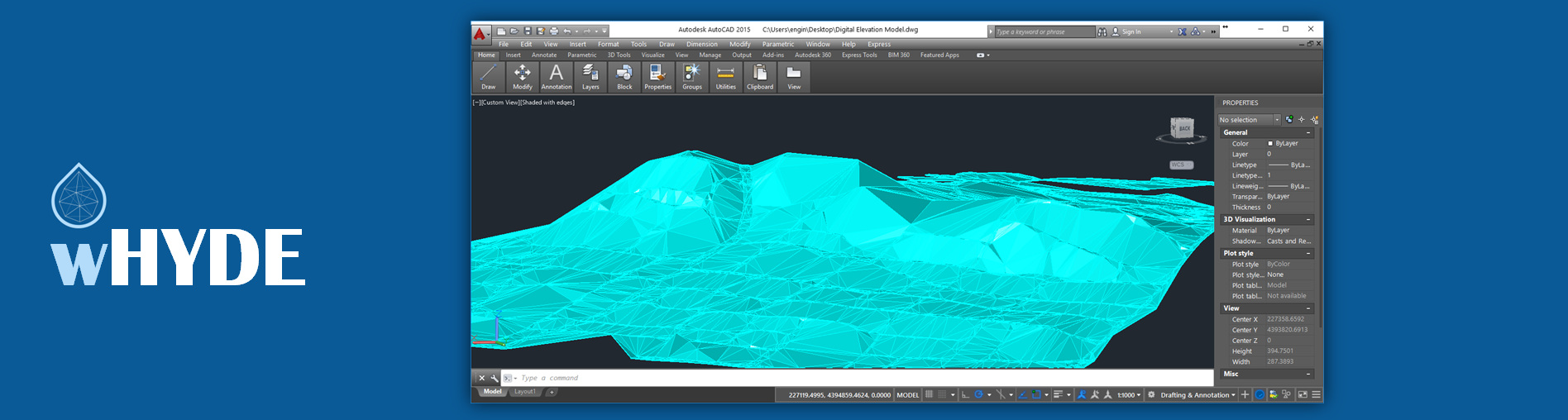
Automatic elevation assignment in nodes from Digital Elevation Model.
Automatic transfer of network layout from AutoCAD into Microsoft Excel.
Hydraulic calculations and pipe dimensioning with constraints set by user (min & max velocities, max flow depths, etc.)
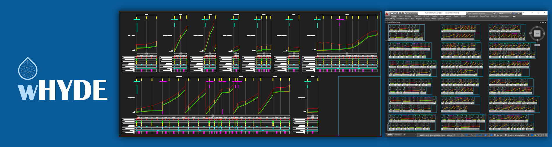
Automatic drawing creation in AutoCAD with ready to print horizontal layouts and longitudinal profiles.
Testimonials
“wHYDE proved to be a powerful professional tool when applied at the demanding topography of Ioannina plane”
C. Giotakis
Managing Director of Municipal Water and Sewage Company of Ioannina
Links
wHYDE is a tool which supports the design of free surface sewer and storm water networks. wHYDE has been developed as an add-on to the familiar working environments of Autodesk AutoCAD and Microsoft Excel, it is easy to use and boosts productivity.
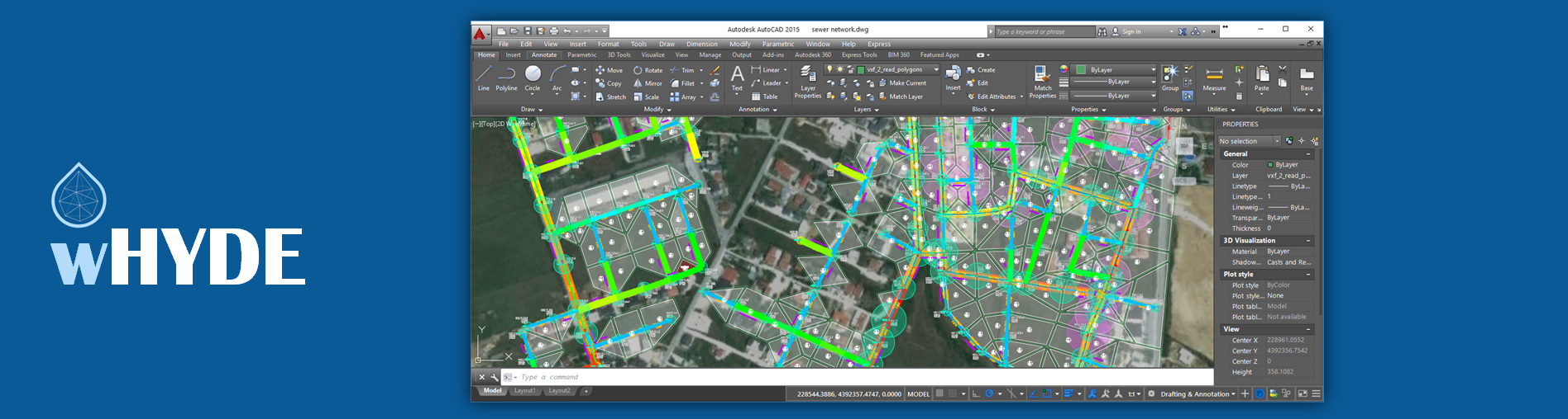
Network overview in AutoCAD
Horizontal network layout is performed in AutoCAD where user designs the pipe network and the junctions (manholes) along with the contribution areas. The AutoCAD environment can support any type of existing drawings (roads, buildings, etc.) or images to be used as base maps in order to facilitate design. wHYDE can handle pressurized pipes and also supports existing networks pipes to be solved simultaneously with new ones. The pipes and junctions labeling is performed automatically while warnings on closed loops and orphan node are also displayed in the AutoCAD environment. Another time-saving option is the automatic assignment of surface elevation at junctions if a DEM surface is available.
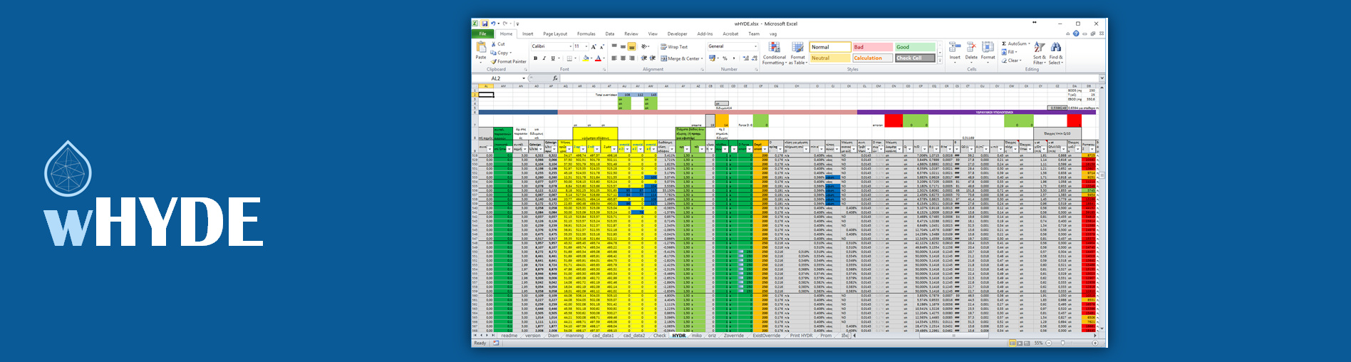
Hydraulics calculations in Excel
The sewer network layout designed in AutoCAD is automatically imported into Excel (including pipe junctions, coordinates, elevations, etc.) where hydraulic calculations and pipe dimensioning are performed. wHYDE solves the network and provides diameters, slopes and elevation for all pipes, however users can override the proposed values if they judge so. The model re-calculates the network areas affected by user changes. Revisions of horizontal and vertical alignments or pipes sizes and depths are easily transferred from AutoCAD to Excel and vice-versa
- Steady and uniform free-surface flow is assumed
- Manning formula with steady or variable roughness coefficient
- Easy data input in Excel sheets (population densities, unit water consumption, pumping station capacity, concentrated flows)
- Calculation of peak factor for every pipe
- Automatic calculation of pipe diameters, slopes and invert elevations
- Constraint check including, min and max velocities, min slopes and depths, max depth of flow ratio etc.
- Elevation checks for upstream confluences and existing pipes
- Capacity and constraints check for existing pipes
- Estimation of sulfide occurrence based on Pomeroy’s Z formula
- Library with commercial pipe sizes
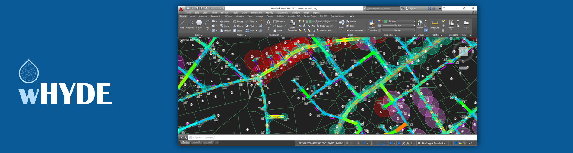
Automatic drawing creation in AutoCAD
When the users finalizes the network dimensioning in the Excel environment, hydraulic calculations (flow rates, velocity, diameters, depths, etc.) are automatically transferred in AutoCAD where the user can have an overview of the proposed solution. Visualization of pipe placement depths and diameters in color coded maps enables identification of problematic areas on the spot.
- Labels with hydraulic data in horizontal layout
- Longitudinal pipe profiles including hydraulic data, upstream confluences, road names etc.
- Ready to print horizontal layouts
- Ready to print longitudinal profiles arranged in plot layout
- Tables with hydraulic data summary for each pipe
- Bill of quantities, including earthworks classified in depth classes